Erin becomes a powerful Category 4 hurricane as it approaches the Caribbean
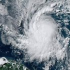
Satellite images indicate that the dangerous weather phenomenon has a small eye and a compact, symmetrical inner core.
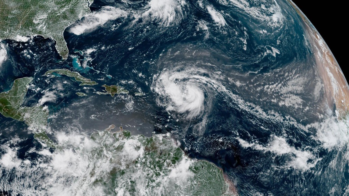
Satellite image of Hurricane Erin

Tropical Storm Erin rapidly strengthened early Saturday morning to become a powerful Category 4 hurricane as it moved toward the Caribbean. A warning was issued that flash flooding and landslides could result from the weather phenomenon.
The National Hurricane Center (NHC) said the storm's maximum sustained winds had increased to 145 miles per hour. According to the 5 a.m. report, Hurricane Erin was at latitude 19.6, longitude 61.5, and moving west-northwest at 17 miles per hour.
Erin, the first hurricane of the Atlantic season this year, was located about 120 miles northeast of Anguilla in the northern Leeward Islands, an area that includes the U.S. and British Virgin Islands.
"Erin is rapidly intensifying"
"Erin is rapidly intensifying and is now a Category 4 major hurricane. Satellite imagery indicates that Erin has a small eye and a compact, symmetric inner core. The hurricane has also maintained a broad area of deep convection southwest of the center, and those outer rain bands are affecting the northern Leeward Islands," the CNH explained in its recent report.
Tropical storm warnings remained in effect for St. Maarten, St. Martin, St. Barthelemy and Sint Maarten, with tropical storm conditions possible within 12 hours.
The center of the hurricane is expected to move over the weekend just north of the northern Leeward Islands, the Virgin Islands and Puerto Rico.
The storm could drench the islands with up to 6 inches of rain in isolated areas, the NHC said. It also warned of "locally significant flash and urban flooding, in addition to landslides or mudslides."

Politics
Trump administration fires all contributors to the government's top climate report
Luis Francisco Orozco
Dangerous storm surges
Storm surges generated by Erin will affect parts of the northern Leeward Islands, the Virgin Islands, Puerto Rico, Hispaniola and the Turks and Caicos Islands over the weekend.
Those storm surges will extend to the Bahamas, Bermuda and the American East Coast early next week, creating "potentially deadly storm surge and rip currents," the NHC said.
The hurricane is forecast to turn northward Sunday night. While forecasters have expressed confidence that Erin will stay away from the American coast, they warned that the storm could still cause dangerous waves and erosion in places like North Carolina.

A more intense hurricane season than normal
The Atlantic hurricane season, which runs from June through the end of November, is expected to be more intense than normal, U.S. forecasters predict.
Several powerful storms wreaked havoc in the region last year, including Hurricane Helene, which killed more than 200 people in the southeastern part of the country.
The National Oceanic and Atmospheric Administration, which operates the NHC, has been subject to budget cuts and layoffs as part of President Donald Trump's plans to greatly reduce the size of the federal bureaucracy, prompting fears of storm forecast failures.
LATEST