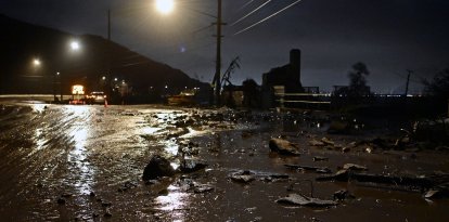
Severe storms, a risk of flooding and a dangerous heat wave will mark the start of the week
Severe storms will continue this Sunday and Monday across the northern Great Plains and the Upper Midwest, while several rounds of rain and thunderstorms will increase the risk of flooding in parts of the northern Great Plains, the Rocky Mountains and the Mid-Atlantic region.

Rain in California

The start of the week will be marked by severe storms, flood risk, critical wildfire conditions and a dangerous heat wave affecting large parts of the country, according to the forecast from the National Weather Service (NWS) Weather Prediction Center.
Severe storms will continue this Sunday and Monday over the northern Great Plains and the Upper Midwest, while several rounds of rain and thunderstorms will increase the risk of flooding in parts of the northern Great Plains, the Rocky Mountains and the Mid-Atlantic region.
The agency explains that a broad upper-level trough over the western part of the country will facilitate the passage of several atmospheric disturbances over the next few days. At the surface, a nearly stationary front extending from the Central High Plains to the Middle Mississippi Valley and the Mid-Atlantic will maintain unstable weather conditions along that swath.

Society
Heavy rain, severe storms and extreme temperatures will mark the start of summer
Williams Perdomo
The combination of abundant moisture from the Gulf of Mexico and an unstable atmosphere will favor the development of multiple episodes of rain and thunderstorms on Sunday in the northern Great Plains, the Upper Midwest and parts of the Mid-Atlantic, Northeast and Southeast.
The National Weather Service warns of a slight risk of excessive rainfall and flooding in parts of the Mid-Atlantic, while there is a marginal risk in areas of the Upper Midwest and the northern Rocky Mountains and Great Plains. The threat of flooding will continue Monday across the northern part of the country due to the development of a new disturbance following the passage of the front which will intensify rain and storm activity.
In addition, between Sunday and Monday there is a slight risk of severe storms in the northern Great Plains and the Upper Midwest. Major hazards include destructive winds, large hail, and the possibility of a couple of tornadoes forming.
In the Southeast, the advance of the front and an upper-level disturbance will favor a typical summer pattern, with scattered to numerous showers and thunderstorms during the afternoon and evening on Monday.
In West Texas, a persistent dry line will trigger repeated episodes of rain and thunderstorms that could lead to localized flash flooding through Monday. Meanwhile, airflow from the ocean toward the northwest of the country and energy associated with another disturbance will bring mixed precipitation to the higher-elevation areas of the northern Great Basin and the Rocky Mountains.
As for temperatures, the western United States will continue to see well-below-average readings, with highs between 20 and 35 degrees Fahrenheit below normal through Monday.
In contrast, a dangerous heat wave will begin to intensify starting this Sunday across much of the central and eastern parts of the country. Highs will generally reach between 90 and the low 100s Fahrenheit, while high humidity will make it feel like between 100 and 110 degrees Fahrenheit.
The heat
Meanwhile, critical wildfire conditions will persist this Sunday in the Four Corners region due to a combination of strong winds, low relative humidity and limited overnight moisture recovery.
LATEST