Winter storm and snow warnings for the Great Lakes region and the Northeast
Much of the eastern part of the country awoke Thursday to cold and below normal temperatures for this time of year, according to the National Weather Service (NWS).

Chicago, Illinois

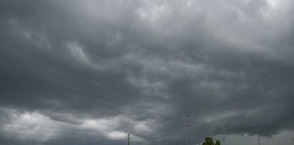
Heavy snowfall on the northwest side will linger today over parts of the Great Lakes and interior Northeast. The National Weather Service (NWS) maintains several alerts in effect for winter storm and lake-effect snow warnings, with an additional six to eight inches of accumulation. Elsewhere in the affected area, precipitation is expected to taper off through the afternoon as the system moves into the Atlantic.
Meanwhile, to the northwest, a clipper-type system moving from south-central Canada into northern Canada, will generate a wide band of snow showers. Light accumulation is expected Thursday in parts of the Upper Midwest and the Great Lakes. Lake-effect snow showers will intensify Friday, particularly in the northern Upper Peninsula and western Lower Peninsula of Michigan. From Friday night into Saturday, the system will cross the Great Lakes bringing a mix of precipitation from the Midwest to the Northeast and Mid-Atlantic.
The weather agency also warns that deep low pressure descending southward will funnel a marked northerly flow over the Rockies and High Plains today and tomorrow, with gusts that could reach between 40 and 65 mph.
What is a clipper-type system?
Although it does not usually generate major storms, it does cause abrupt changes in weather:
- Rapidly falling temperatures
- Strong winds
- Light to moderate snow
- Very low thermal sensation
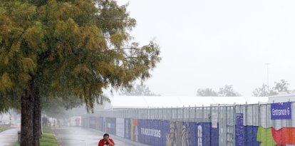
Much of the eastern United States woke up Thursday to temperatures well below normal for this time of year, according to the National Weather Service (NWS). Forecast highs ranged from 20 to 30 degrees in the Great Lakes region and the Northeast, while in lower Mississippi and the Southeast are expected to experience values between 30 and 40 degrees.
Below-freezing lows temperatures will persist Friday across most eastern states, including parts of northern and central Florida, where frost advisories are in effect for the risk of damage to crops and sensitive vegetation. A brief rebound in daytime temperatures is expected during the day tomorrow, before a clipper-type system drags polar air southward across central and eastern Florida between Friday night and Saturday.
Warm conditions in the west
In contrast to the widespread cold in the eastern half of the country, the western United States is experiencing significantly warmer than normal conditions. A strong high-pressure ridge is maintaining elevated temperatures, with highs forecast to reach 50 degrees in the interior West and Pacific Northwest, the 60s and 70s in California and between 70 and 80 degrees in the Desert Southwest.
The NWS warns that this stark thermal contrast between the two coasts will persist for the next several days, as different atmospheric systems continue to move across the country.
LATEST