NWS warns of strong winds and hail over 5 cm in diameter in southeast
Authorities have advised the public to monitor forecast updates closely.
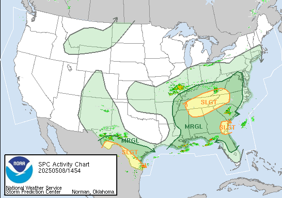
NWS forecast map

The Southeast is expected to face several days of severe weather through the weekend, the National Weather Service (NWS) reported. Early in the period, some areas may experience flash flooding.
The NWS reported that scattered thunderstorms are expected Thursday across the Tennessee River Valley and the Southern Appalachians, bringing strong wind gusts and large hail, potentially exceeding 5 centimeters in diameter.
By Thursday afternoon, the storms are expected to move into Alabama, Georgia, and North Carolina. In North Carolina, the National Weather Service office in Raleigh has urged the public to monitor weather conditions closely throughout the day and to ensure they have multiple ways to receive alerts.
"Damaging straight-line winds and large hail are the primary threats today, mainly between 4 PM and 11 PM," warned the NWS Raleigh.
At the same time and continuing into the evening, another area of severe weather could develop over southeastern Georgia, the southern tip of South Carolina, and northern Florida. Parts of Texas, including cities like Laredo and Brownsville, may also experience high winds, large hail, and even tornadoes.
LATEST