Arthur exacerbates flood threat in the South; millions remain on alert
In Texas, authorities reported at least two deaths related to the heavy rains that fell this week.
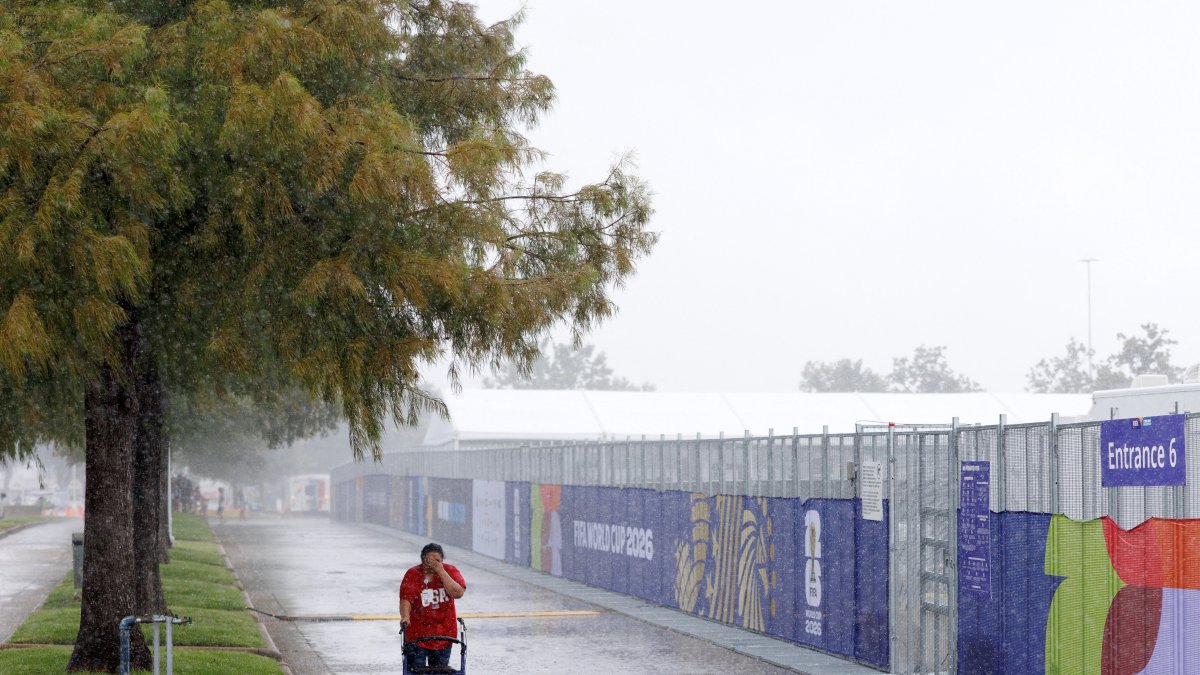
A man walks in the rain in Texas (File photo)

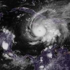
Tropical Storm Arthur, the first named system of the 2026 Atlantic hurricane season, made landfall Wednesday on the Texas coast, intensifying a flooding emergency already affecting several Southern states and expected to persist through the coming days.
Although Arthur made landfall in the United States with sustained winds of about 45 mph, meteorologists agree that the main threat is not the winds or storm surge but rather the torrential rains capable of producing potentially deadly flash floods from Texas to the Southeast.
According to the National Hurricane Center (NHC), the system made landfall in Matagorda County, south of Houston, while dragging a massive plume of tropical moisture that will continue to fuel intense storms even after Arthur’s circulation weakens over land.
Forecasts call for additional rainfall totals of 5 to 10 inches (127 to 254 millimeters) across large parts of the region, though some areas could see up to 20 inches (508 millimeters), especially where the ground is already saturated from several consecutive days of rain.
Deaths and flooding before the storm hit
The effects of Arthur began to be felt even before the system was officially named.
In Texas, authorities reported at least two deaths linked to heavy rains this week. One victim, a 53-year-old woman, died after her vehicle was swept away by a flash flood near San Antonio. Rescue teams later located the car in a remote creek.
In Montgomery County, north of Houston, a 15-year-old drowned in a flooded retention pond while playing with other young people in an area affected by the rains.
Local authorities have warned that even small amounts of moving water can pose extreme danger to pedestrians and drivers. Experts remind the public that just 6 inches (15 centimeters) of flowing water can knock down an adult, while about 12 inches (30 centimeters) is enough to sweep away most vehicles.
States under watch
The heaviest rains are concentrated in Texas, Louisiana, Mississippi, Alabama, Georgia, Florida and South Carolina.
Among the cities remaining under weather watch are:
- Houston, Galveston and Port Arthur in Texas.
- Lafayette, Baton Rouge and New Orleans in Louisiana.
- Hattiesburg and Gulfport in Mississippi.
- Mobile, Montgomery and Birmingham in Alabama.
- Atlanta, Macon and Augusta in Georgia.
- Pensacola in Florida.
- Columbia, Charleston and Myrtle Beach in South Carolina.
The National Hurricane Center also warned of the possibility of isolated tornadoes as the remnants of the system move toward the eastern and northeastern United States.
A weak but extremely dangerous system
Experts emphasize that the strength of a tropical storm does not always determine the level of destruction it can cause.
Arthur exhibits characteristics similar to other relatively weak systems that have caused severe flooding in recent years, including Tropical Storms Barry and Chantal, which resulted in loss of life and millions of dollars in damage after dumping enormous amounts of rain on Texas and North Carolina.
"Life-threatening flash flooding remains the primary threat and will persist even after Arthur dissipates," noted the National Hurricane Center in an update issued Wednesday.
A growing threat in a warmer climate
Warmer air can hold greater amounts of water vapor, which increases the potential for extreme rainfall when tropical systems develop. In 2024, record levels of water vapor were measured in the atmosphere, and experts warn that this trend continues to fuel increasingly intense precipitation events.
According to recent studies, most deaths related to tropical storms in the United States over the past decade have been caused not by winds but by flooding from extraordinary rainfall.
LATEST