Winter storm threatens Midwest and Northeast: More than 40 million people on alert for possible 'bomb cyclone'
The weather event will arrive between Sunday night and this Monday, just days after another storm hit the tri-state region, increasing the risk of extremely hazardous travel conditions, power outages and massive transportation delays.
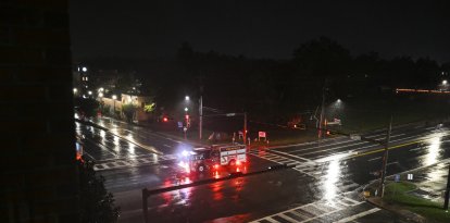
People under a winter storm in New York (File).

A dangerous winter storm is moving toward the nation's Midwest and Northeast, putting more than 40 million people on alert as meteorologists warn the system could evolve into a phenomenon known as a "bomb cyclone," according to NPR.
The weather event will arrive between Sunday night and this Monday, just days after another storm hit the tri-state region, increasing the risk of extremely hazardous travel conditions, power outages and massive transportation delays.
What is a "bomb cyclone"?
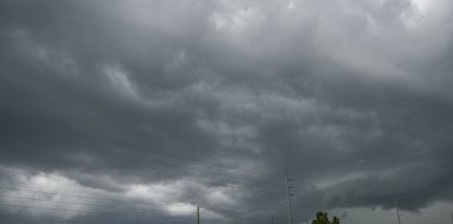
In this case, the combination of accumulating snow, arctic air and mixed precipitation could exacerbate the impact, especially in densely populated urban areas.
Midwest: heavy snow and winds up to 60 mph
During Sunday morning, blizzard warnings were issued from North Dakota to Minnesota and Iowa, where three to eight inches of snow is expected, accompanied by sustained winds of up to 45 mph, according to weather reports.
In Minnesota, conditions will be even more severe. The Upper Peninsula could record accumulations of between nine inches and up to two feet of snow, with wind gusts up to 60 mph. Winter storm warnings were also activated for the eastern part of the state, including the Minneapolis metro area, from Sunday through this Monday.
Forecasters warned that wind-blown snow could generate whiteout conditions (near-zero visibility), raising the risk of roadway accidents.
Northeast: freezing rain, high winds and flooding
In the Northeast, winter weather warnings extend from Pennsylvania to Maine, with particular concern for freezing rain expected between Sunday night and Monday.
The state of New York faces a complex scenario:
- Buffalo and Jamestown are under flood warnings, with forecasts of up to 3.8 centimeters of rain.
- In New York City, experts warned that existing snow could freeze, worsening traffic conditions as colder air arrives.
Higher elevation areas of northern New England and much of Maine could experience a dangerous mix of snow, sleet and freezing rain.
">5:25pm update: We have expanded the winter weather advisory to include the NYC metro, Long Island, and SE coastal Connecticut until 10pm. There is the potential for a light glaze of ice this evening in light freezing rain/drizzle. Temperatures will rise above freezing overnight. pic.twitter.com/v6NdBNOPI5
— NWS New York NY (@NWSNewYorkNY) December 28, 2025
Impact on travel and airports
Bad weather is already affecting year-end travel, one of the busiest travel periods in the United States. According to data from FlightAware:
- John F. Kennedy (JFK) and LaGuardia, in New York, were recording average delays of at least 30 minutes Sunday night, trending upward.
- At Minneapolis-Saint Paul International Airport, located near the storm's core, arrivals and departures were accumulating delays of about an hour, steadily increasing.
Airport and transportation authorities urged travelers to check the status of their flights, consider itinerary changes and exercise extreme caution on the road.

Society
Storms before Christmas: How to adapt your travel plans in the face of NWS warnings
Santiago Ospital

Society
Guía de viaje ante la tormenta invernal: aeropuertos afectados, cierres de rutas y alertas del NWS
Santiago Ospital
A system in constant evolution
Meanwhile, emergency services recommend avoiding unnecessary travel, preparing emergency kits and keeping an eye on official warnings as this potential "bomb cyclone" approaches two of the country's most populated regions.
LATEST