Heavy rain and snow will mark Christmas Eve and Christmas Day
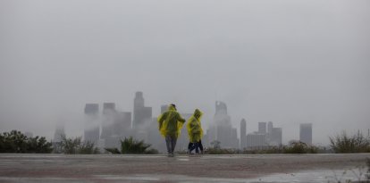
Heavy precipitation will persist in California through Christmas Day. For this reason, the WPC has issued a Moderate Risk (level 3 of 4) of excessive precipitation for parts of Southern California Thursday through Friday morning.
Snow in the United States

The Weather Prediction Center (WPC) reported that a high risk of excessive rainfall will be recorded in parts of southern California this Wednesday, while a wintry weather scenario will affect large parts of the country in the days leading up to and through Christmas.
According to the forecast, a front associated with a weather phenomenon that will move away from the northeast coast during Wednesday morning will remain nearly stationary over the southeastern part of the country through Friday. At the same time, moisture flowing in from the Gulf of Mexico will favor the development of showers in sectors of the Ohio and Tennessee valleys through Wednesday afternoon.
On the other hand, a wave of low pressure will form over portions of the Middle Mississippi Valley and advance into the Ohio Valley and central Appalachians by Thursday morning. This phenomenon will bring showers to areas of the Mid-Atlantic during Christmas morning.
At the northern edge of the precipitation band, pockets of rain and freezing rain are forecast for areas of Pensilvania, the Great Lakes and northern Mid-Atlantic between Christmas Eve and Christmas Day.
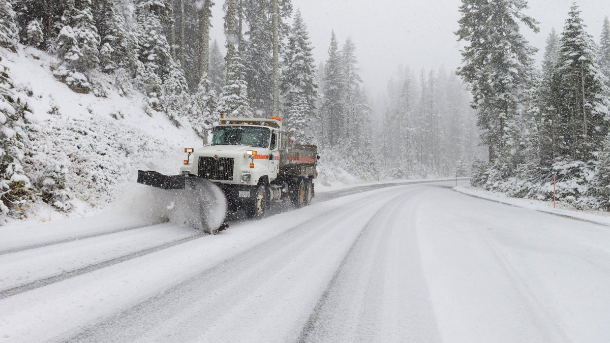
As low pressure moves away from New England, moderate to heavy snow will develop in that region through Wednesday afternoon, with snow lingering in the northeast through Christmas. Moderate to heavy snow is also expected in the Sierra Nevada Mountains, which could linger through Friday.

Society
Snowstorm hits Connecticut: school closures, dangerous roads and full forecast
Diane Hernández
On the West Coast, moisture and upper-level pulses from the Pacific will move eastward on Wednesday as a front moves inland. This pattern will bring rain and snow to the higher elevations of the Pacific Northwest, northern California and the northern intermountain region.
In addition, an intense moisture-laden airstream will produce heavy rainfall in California on Wednesday, with very heavy rainfall in parts of the southern part of the state. Given this scenario, the WPC has issued a High Risk (level 4 of 4) for excessive rainfall for Southern California through Thursday morning. Widespread severe flash flooding is expected, even in areas that do not normally experience such events, with severe danger to life and property.
A Mild Risk of excessive rainfall has also been posted for northern and central California, as well as parts of southern Nevada through Wednesday. Heavy snow will continue in the Sierra Nevada through Friday, while showers and snow at higher elevations will affect the Great Basin and southwestern parts of the country.
Rains during Christmas
LATEST