Snowstorm hits Connecticut: school closures, dangerous roads and full forecast
The storm will bring a mix of rain, freezing rain and snow, with accumulations ranging from 1 to 3 inches depending on the region.

Image of a woman in the middle of the snow (File).

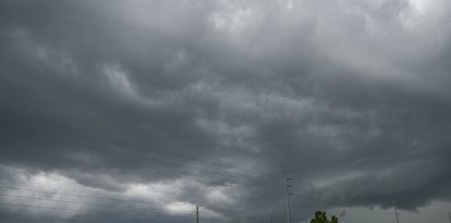
A winter storm is affecting Connecticut this Tuesday, just ahead of the Christmas holidays, leaving slippery roads, widespread school closures and travel complications on one of the busiest travel days of the year. The National Weather Service (NWS) issued a winter weather advisory in effect until 4 p.m.
">Winter Weather Advisories have been issued for portions of northeast NJ, the Lower Hudson Valley and southwestern CT. Snow/slush covered roads may result in hazardous travel during the Tuesday AM commute.#NYCwx #NYwx #CTwx #NJwx pic.twitter.com/fon9od51hd
— NWS New York NY (@NWSNewYorkNY) December 22, 2025
What's going on with the weather in Connecticut?
The storm will bring a mix of snow, freezing rain and rain, with accumulations ranging from 1 to 3 inches. Temperatures remained below freezing during the early morning and will slowly rise into the 30s during the day, favoring ice formation on roads and sidewalks.
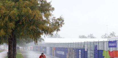
"Expect slippery road conditions and reduced visibility during the morning," warned the NWS.
Although heavy snowfall is not expected, moderate snow showers could briefly reduce visibility, particularly during the morning commute, prompting warnings from authorities take precautions.

Impact on traffic and holiday travel
- Morning: widespread snow and slippery untreated surfaces.
- Evening: mixed with rain, especially in coastal areas.
- Evening: risk of residual ice as temperatures drop again.
It is recommended to reduce speed, increase the distance between vehicles and avoid unnecessary travel during the peak hours of the winter storm.
How much snow is expected in each region?
Coast (Stamford, Bridgeport, New Haven, New London)
- Light snow mixed with rain
- Accumulation: up to 1 inch of wet snow
- Highs: 35-40 °F
Inland areas (Danbury, Waterbury, Hartford, Windham)
- Light to moderate snow early
- General accumulation: 1 inch
- Highest areas: up to 3 inches
- Highs: 34-36 °F
Litchfield Hills (Torrington, Litchfield, Winchester)
- Pure snow event
- Accumulation: 1 to 3 inches
- Major impact on elevated areas
December with less snow, but colder than normal
So far, December has recorded below-average snowfall in Connecticut. In Hartford, prior to this storm, only 4.1 inches had accumulated, compared to the usual monthly average of 6.4 inches.
However, temperatures have been nearly 5 degrees colder than normal, making this December feel more like February. All indications are that the month will close with below average thermal values.
Schools closed in Connecticut on Tuesday
Also suspended activities were all Connecticut State Community College campuses, including Capital, Housatonic, Manchester, Middlesex, Norwalk, Tunxis and Naugatuck Valley, as well as the Goodwin University magnet school system.
Education officials advised families to stay tuned for possible updates throughout the day.

Society
Storms before Christmas: How to adapt your travel plans in the face of NWS warnings
Santiago Ospital
What to expect after the storm?
Conditions will begin to improve toward Tuesday night and Wednesday, Christmas Eve, will bring a calmer outlook, with mostly sunny skies and temperatures near 40 degrees Fahrenheit.
Christmas Day is shaping up to be dry and in keeping with the season, although overnight showers or light snow showers are not ruled out, which at this time are not expected to cause major inconveniences.
">Snow develops across the region over the next couple of hours, before mixing with and changing to rain for most by the afternoon.
— NWS New York NY (@NWSNewYorkNY) December 23, 2025
⚠️ Expect travel impacts for the AM commute w/ reduced visibilities and slick conditions on untreated surfaces!
💻 Forecast: https://t.co/kd4x2H2ULS pic.twitter.com/oW41ICN3R3
Final recommendation
Keep an eye on the National Weather Service updates, check road conditions before heading out and confirm directly with your school district for any last-minute changes.
LATEST