Breather for the Atlantic: Forecasters predict calmest hurricane season in 13 years
Experts attribute this decline in activity to the strengthening of El Niño, which could become one of the most intense on record.
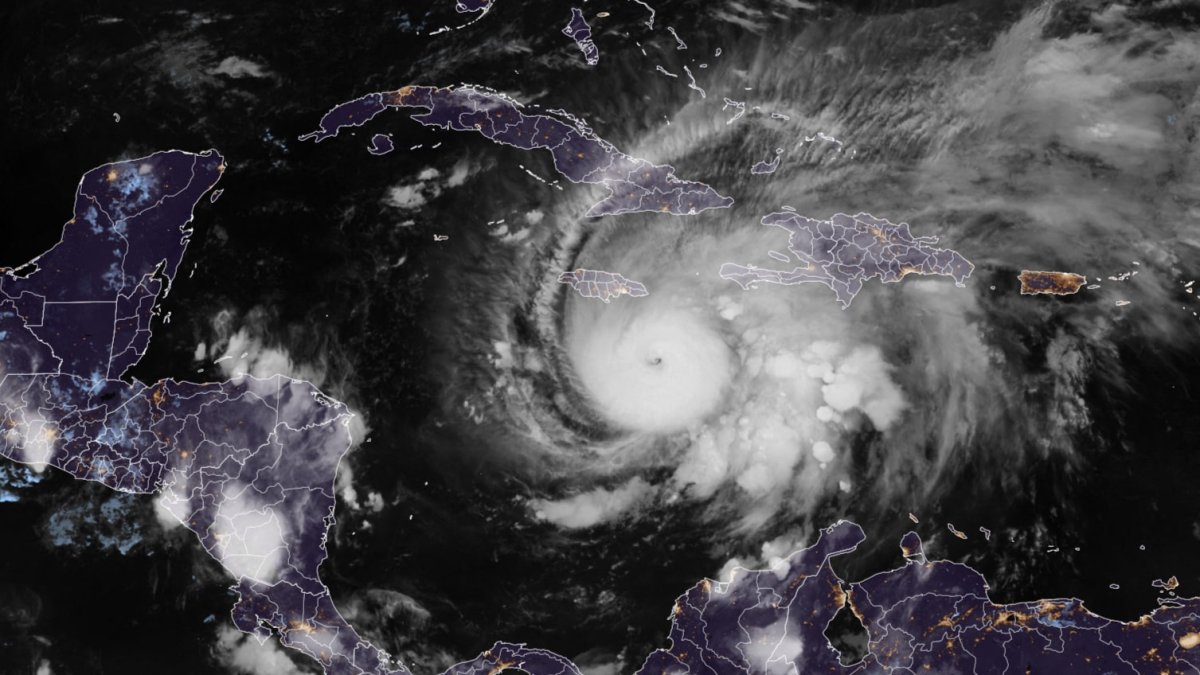
Hurricane Melissa southeast of Jamaica (File photo)

The 2026 Atlantic hurricane season could become the least active in the last 13 years. This is indicated by the updated forecast prepared by researchers at Colorado State University (CSU), which predicts cyclonic activity well below the historical average due to the strengthening of El Niño.
Only nine named storms
According to the report cited by The Washington Post, only nine named storms are expected to form throughout the season, compared to the historical average of 14.4 systems. So far, Tropical Storm Arthur already brushed the Texas coast between June 17 and 18.
Of the eight remaining storms forecast for this year:
- Four are expected to reach hurricane strength.
- Only one is expected to become a major hurricane, that is, a Category 3 or higher storm.
- Lower risk for the United States.
The forecast also significantly reduces the probability that a major hurricane will make a direct landfall in the country.
Researchers estimate a mere 17% probability that a major hurricane will make landfall in the country, well below the 43% that is typically the average risk for a season.
Another indicator reflecting the expected low activity is Accumulated Cyclone Energy (ACE), a measure that quantifies the total energy generated by tropical storms and hurricanes. For this year, ACE is projected to reach only 40% of the historical average, particularly low in the western Atlantic, the region with the greatest influence on the United States.

El Niño: The main explanation
Experts attribute this decline in activity to the strengthening of El Niño, which could become one of the most intense episodes on record.
The warming of the waters in the tropical Pacific promotes storm development in that basin, but at the same time alters atmospheric circulation over the Atlantic.
This process has two main effects:
- It increases wind shear—that is, changes in wind speed and direction with altitude—making it more difficult for tropical cyclones to form and intensify.
- It promotes the descent of air masses over the Atlantic, inhibiting the development of new storms.
In addition, Atlantic sea surface temperatures are closer to normal values, a far cry from the exceptional warmth recorded in recent seasons—another factor that limits the formation of intense cyclones.

World
Heatwave in Europe: High temperatures claim more than 3,000 lives in France and Belgium
Carlos Dominguez
Low activity does not eliminate risk
“As with all hurricane seasons, coastal residents are reminded that it only takes one hurricane making landfall to make it an active season,” noted meteorologists at Colorado State University.
As an example, they cited the 1992 season, which saw below-average hurricane activity and produced only one major hurricane. However, that single system was Andrew, a Category 5 hurricane that devastated South Florida and caused catastrophic damage.
LATEST