Hurricane Erin downgraded to Category 3, but still threatens East Coast
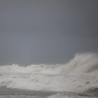
Authorities warned North Carolina especially, where mid-week could see 20-foot waves, coastal flooding and storm surges.
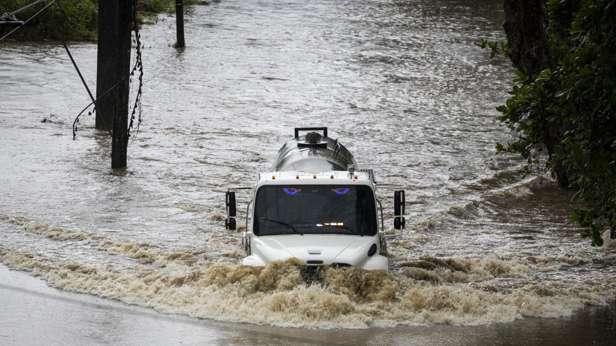
Hurricane Erin in Naguabo, Puerto Rico

Hurricane Erin hit the Caribbean islands Monday with strong gusts and rain. Although the first hurricane of the season in the North Atlantic had reached the highest category (5) on the Saffir-Simpson scale over the weekend, it later weakened to Category 3.
Despite this decline, fears continued to grow for rip currents and flooding along the east coast of the U.S. "Erin is expected to produce life-threatening surf and rip currents along the beaches of the Bahamas, much of the east coast of the U.S., Bermuda, and Atlantic Canada during the next several days," the National Hurricane Center (NHC) warned in its latest report. "Beachgoers in those areas should follow advice from lifeguards, local authorities, and beach warning flags."
It also added that stormy conditions and flooding were "possible" on the Outer Banks of North Carolina beginning Wednesday night.
Jamie Rhome, deputy director of the agency, warned Americans not to assume that the hurricane will not impact just because its path is offshore. "Nothing could be further from the truth for portions of the Mid-Atlantic, especially the Outer Banks of North Carolina," he said in remarks picked up by AFP. On Wednesday and Thursday waves of up to six meters, coastal flooding and storm surges could "could overwash dunes and flood homes, flood roads and make some communities impassable," he added. Beginning Tuesday on the East Coast, there will be high risk of dangerous surf and rip currents driving water away from the shore.
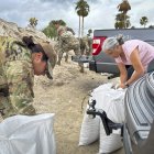
"Now is the time to make final preparations, secure property, and evacuate with all personal belongings," warned authorities in Hyde County over the weekend, issuing a state of emergency. And also:
"Dangerous waves, 20+ feet, will likely inundate and destroy protective dune structures along the highway. Portions of Highway 12 on Ocracoke and Hatteras Islands will likely be impassable for several days. Life-threatening swimming and surfing conditions are expected. Rip current risks will be extremely high! Stay out of the water!"
Hours later, Dare County followed suit, accompanying the emergency declaration with evacuation orders:
Caribbean impact
Erin is "unusually large," with hurricane-force winds extending up to 80 miles outward from the eye of the hurricane and tropical storm-force winds up to 230 miles away, the NHC said. The outer part of the phenomenon is forecast to dump rain over Cuba and the Dominican Republic all day Monday, as well as in Turks and Caicos and the Bahamas, where a tropical storm warning is in effect for Tuesday.
In those regions, rainfall could reach 4 inches, according to the NHC.
Hurricane season more severe than normal
In 2024, the region was hit by several deadly storms, including Hurricane Helene, which caused more than 200 deaths in the southeast of the country.
This year, tropical activity is expected to be elevated due to a combination of warmer sea surface temperatures in the tropical Atlantic and Caribbean, along with an active monsoon in West Africa, the U.S. National Oceanic and Atmospheric Administration (NOAA) said.
Society
Hurricane season 2025: Protecting your home and building the ultimate survival kit
Santiago Ospital
LATEST