Severe storms in northeastern Oklahoma: prolonged risk through Sunday
Weather authorities and monitoring teams warn of the possibility of multiple rounds of storms through Sunday, some with severe potential.

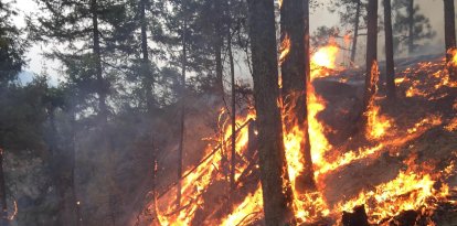
Damage caused by tornadoes in the western U.S. (Archive)

The heavy storms recorded overnight Thursday in northeastern Oklahoma mark the start of an episode of instability that could extend for several days across much of the eastern part of the state. Weather authorities and monitoring teams are warning of the possibility of multiple rounds of storms through Sunday, some with severe potential.
Overnight Thursday, April 23, several warnings were issued for severe thunderstorms and tornadoes affecting not only northeastern Oklahoma, but also areas of southeastern Kansas and northwestern Arkansas. These warnings remained active at various times during the early morning hours, effective in some cases until 4:00 am, while tornado warnings were extended in specific areas until about 11:00 pm.
Initial impact and evolution of the storms
The storms began to develop late Thursday afternoon, intensifying overnight. Severe phenomena were reported at several locations, including:
- large hail.
- Damaging wind gusts reaching up to 112 km/h.
- Confirmed tornadoes, such as those observed near Braman and south of Enid.
Notably, tornado warnings were issued for multiple counties, including Kay, Noble, Osage, Pawnee and Payne. Some of these warnings expired earlier than anticipated, although the risk persisted for several hours due to dynamically evolving storm cells.
In addition, large areas of the so-called "Green Country" remained under severe thunderstorm warnings, including counties such as Tulsa, Rogers, Muskogee, Wagoner and Washington, among others.
Care for the injured in Enid after tornadoes hit
According to local reports, the hospital requested staff reinforcements as patients arrived, while emergency agencies from nearby areas are assisting in the response. Authorities confirmed at least one transfer to Integris Hospital in Enid for a person with leg lacerations after hitting a wall.
Current situation and weather conditions
According to meteorologists, the system responsible for these storms will continue to move eastward through early Friday morning. However, the atmospheric situation will remain conducive for convection.
A key element will be the presence of a cold front that is expected to remain virtually stationary over the region on Friday. This pattern will favor the regeneration of thunderstorms throughout the day and into the weekend.
Short-term forecast
The forecast scenario, according to the weather forecasts, indicates:
- Friday: possible reactivation of thunderstorms, with progressive increase in coverage during the day.
- Saturday and Sunday: new rounds of thunderstorms, some potentially intense, with cumulative risk of significant rainfall.
Although the risk of tornadoes remains relatively low compared to other threats, isolated formation of these phenomena is not ruled out. The main concerns continue to be large hail, high winds and intense precipitation in short periods.
Recommendations
- Keep informed through official sources.
- Have emergency plans ready, especially in areas under tornado warning.
- Avoid unnecessary travel during severe storms.
LATEST