Winter storm with 'lake effect' threatens Central New York
Parts of the Midwest of the state, including the Syracuse area, are expected to receive about 24 inches of snow (60 cm), while other areas of Central New York could receive 12 to 18 inches (30 to 45 cm) or more, depending on localized snow bands.
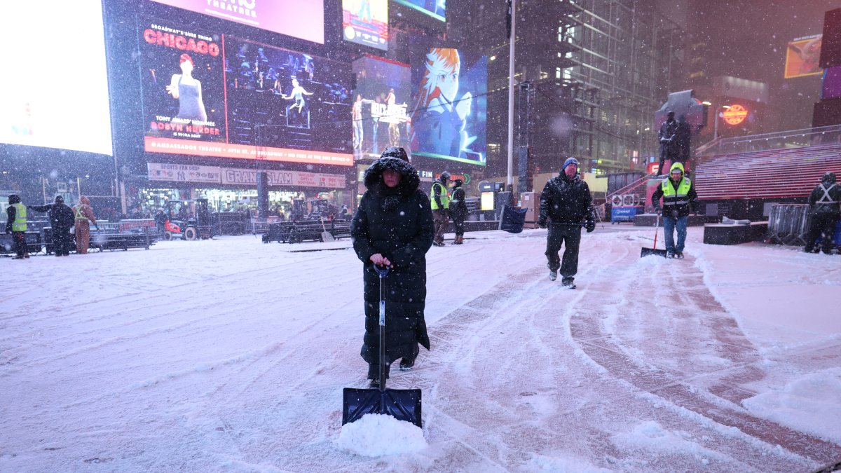
Workers clear snow from the streets of New York.

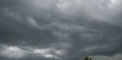
An intense winter storm with a lake effect is moving through the center of the state of New York and could leave more than 24 inches of snow (more than 60 cm) in some areas, along with heavy winds and hazardous travel conditions.
Gov. Kathy Hochul declared a state of emergency across New York state due to an intense winter storm, affecting western New York, the Finger Lakes, central New York and the North Country throughout the week.
General forecast and snow accumulations
The National Weather Service (NWS) indicated that the snow storm with a lake effect warning will remain in place Monday night through Wednesday, with significant accumulations expected.
In parts of the Midwest of the state, including the Syracuse area, about 24 inches of snow (60 cm) is expected, while other areas of the Midwest could receive 12 to 18 inches (30 to 45 cm) or more, depending on localized snow bands.
In locations such as Baldwinsville, accumulations could reach up to 30 inches (76 cm) by Wednesday night.
The lake effect phenomenon will continue to generate intense and persistent snowfall, with narrow bands that can cause marked differences in accumulation over short distances.
The NWS warns that visibility could be extremely limited or near zero during periods of heaviest snow.
What is the 'lake effect' and how can it affect us?
Main characteristics:
- Narrow bands of snow: Snow can fall very heavily in very localized bands, while a few kilometers away it hardly falls at all.
- High accumulation in a short time: Snowfall rates can be 2 to 3 inches (5-8 cm) per hour.
- Reduced visibility: Can cause blizzard-like conditions, making driving difficult.
- Variable duration: As long as the wind maintains the correct direction and the lake is not frozen, snow can persist for hours or even days.
- Affected areas: Cities near the Great Lakes, such as Syracuse, Buffalo, Rochester or Watertown, usually receive the heaviest accumulations.
In short, the lake effect turns the lakes into an intense snow "engine," generating localized but very strong storms that can severely affect mobility and safety.
Snow intensity, winds and wind chill
- Snow could fall at an intensity of 2 to 3 inches per hour (5 to 8 cm per hour) during the heaviest periods.
- Strong westerly winds are expected, with gusts that could reach up to 50 miles per hour (80 km/h).
- Cold temperatures combined with the wind will maintain a wind chill of no more than 10 degrees Fahrenheit this Tuesday.
">[4:23am]: Good Morning! Still windy out this morning with W/NW gusts in the 30s and 40s across the area. A wind advisory remains in effect until 6pm tonight for the entire area. Winds should gradually taper through the day. Full forecast at: https://t.co/wTqdsomHTB pic.twitter.com/gjzhbOlTFg
— NWS New York NY (@NWSNewYorkNY) December 30, 2025
Hazardous conditions and travel advisories
Severe weather could make driving extremely dangerous, especially during the night and early morning hours.
According to the National Weather Service, the combination of heavy snow and wind will cause blizzard-like conditions, with rapid accumulation and covered roads.
Officials in Onondaga and Madison counties have warned residents to avoid unnecessary travel while the storm persists.

Closures and official actions
- Non-essential state employees in several counties were instructed to work from home.
- Road closures and traffic restrictions are in place on state roads and highways, including bans on empty tractor-trailers and tandems.
- Emergency crews and utilities are actively working to maintain safety and restore power in affected areas.
A winter storm warning remains in effect until 7 a.m. Wednesday, while snowfall and high winds continue.
LATEST