Flood evacuations in Washington: when will the 'atmospheric river' end?
After setting rainfall records, the risk of flooding and landslides continues to rise. More than 100,000 people are under evacuation orders in Washington, while Oregon and Idaho also remain on alert.

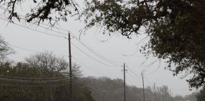
The states of Washington, Oregon and Idaho have experienced strong rainfall events in recent days that led to flash flooding in several areas, due to a meteorological phenomenon called atmospheric flooding.
The National Weather Service reported Thursday that the phenomenon that left between 12 and 25 centimeters (between 5 and more than 10 inches) in those three states throughout the week "will finally come to an end today." The risk from flooding, however, will continue in the coming days.
"While the heaviest rainfall is subsiding, lingering rain through Friday will exacerbate ongoing major river flooding," it added.
He also clarified that "landslides will continue across portions of western Washington state and northwest Oregon for several days."
Indeed, authorities continue to issue evacuation orders and urge caution when getting behind the wheel.
In Washington, some 100,000 residents received evacuation orders in the last few hours. This was stated by Governor Bob Ferguson, who assured that they expected the rivers to reach "historic levels as early as 4 a.m. tomorrow, lasting into Friday morning."
At midnight Wednesday, Skagit County, Washington, urged several of its residents to "evacuate to high ground immediately." "Do not wait."
Evacuation orders were also issued in Oregon, such as at Oxbow Regional Park, and roads had to be closed, mainly along the coast. The status of the latter can be found at tripcheck.com.
What are the two rivers are at greatest risk?
The two rivers that pose the greatest risk according to experts are the Skagit and the Snohomish. Both are located north of Seattle. They could surpass records by early Thursday.
On Friday, the floods would continue, according to official estimates. Near Concrete, the Skagit could rise 13.5 centimeters (44.47 feet) by midday Friday. The previous all-time record was 12.8 centimeters (42.2 feet), although this could have already been broken by Thursday, when some estimates mark 14.3 meters (47 feet) of flooding. New records are also expected in other areas of the river.
"I just got off the phone with the National Weather Service and am alarmed to hear that the Skagit River will peak 4-5 feet above the record crest level," Washington Sen. Maria Cantwell maintained. "Please please stay alert and follow evacuation orders. This is not just another flood."
For its part, the Snohomish will brush highs on Friday, though it would appear to fall short of passing them. Both near Monroe and near Snohomish will be near record highs on Friday. Updated estimates can be found at a live map from NOAA.
Record rainfall
Beyond the rainfall and flooding expected over the next few days, record rainfall has already been experienced during the week. Governor Bob Ferguson declared a state of emergency, anticipating that the cost of repairs will be "significant."
In the Olympia area, the state capital, already on Monday rainfall broke a 10-year record with 7.6 centimeters (3.03 inches) compared to 6.3 centimeters (2.50) in 2015. This Thursday, the NWS raised the counter to more than 17 centimeters (7). Record highs were also exceeded in Bellingham, it said.
Portland, Oregon's most populous city, also saw record highs even earlier in the week. The 4.2 centimeters (1.66 inches) recorded Tuesday surpassed the previous high of 3.6 reached in 2010, according to local media KATU 2. Salem also broke the previous record with 4.3 centimeters (1.74 inches) compared to 1.63 in 1987.
What is an atmospheric river?
In fact, according to the weather service, an average AR can be compared to the flow of the Mississippi River at its mouth. Although in the former, the water is not in a liquid state, but gaseous (known as water vapor).
Exceptionally powerful atmospheric rivers can carry up to 15 times the flow of the Mississippi.
They generally extend thousands of kilometers long and hundreds of kilometers wide.
At landfall, their water vapor usually turns into rain or snow. In cases such as this week's AR, if it contains large amounts of water vapor it can generate heavy rain and flooding.
LATEST