Over 40 million people at risk as heatwave approaches
The National Weather Service warned that the southern part of the country could experience temperatures above 100ºF over the next few days.
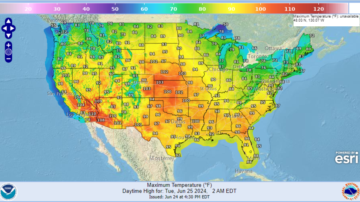
Weather map of the United States provided by the National Weather Service on Monday, June 24, 2024.

A total of 44 million people are on alert as an extreme heat wave approaches. The National Weather Service has warned that temperatures in the southern part of the country could range from 90 to 100 degrees Fahrenheit, with cities like New Orleans, Louisiana, potentially exceeding 110 ºF:
New Orleans is not the only city facing extreme temperatures. According to CNN, cities like Dallas and Little Rock could see temperatures surpassing 100ºF while other southern cities in the country may average 90ºF. The National Weather Service in Fort Worth advises taking precautions as these high temperatures can pose significant health risks.
"During hot and humid weather (like in the forecast this week!), your body’s ability to cool itself is challenged in ways you may not expect," warned the weather agency which, in turn, reported that the heat wave could extend through Friday.
Storms in the Midwest
While the intense heat is approaching the south of the country, the Midwest has been rattled by intense storms for several days. Alex Sosnowski, senior meteorologist for AccuWeather, said this could continue through the end of the month:
"So much rain has fallen in a zone from southwestern Minnesota to northeastern Nebraska, including northwestern Iowa and southeastern South Dakota, that multiple rivers are on the rampage. Several major rivers in the region, including the Big Sioux and West Fork of the Des Moines rivers, will be in major to record flood stage through early week."
According to the weather website, the storms will continue on Monday across parts of Minnesota and Wisconsin, potentially briniging "numerous severe thunderstorms." By Tuesday morning, these storms are expected to move towards Chicago and Detroit.
Following this, the storm will move toward Kansas City, St. Louis and Indianapolis. These areas could be impacted by storms starting Tuesday afternoon and becoming more intense through the night.
Throughout Wednesday, the storms will progress to Ohio and New England. These regions are expected to get precipitation along with intense heat. AccuWeather meteorologist Brandon Buckingham said:
"Behind this front, an extended stretch of more seasonable heat is anticipated across the Northeast heading into late this week."
LATEST